#EUSpace
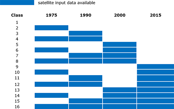
This data grid is a complementary information layer to the multitemporal GHS built-up grid (1975, 1990, 2000, 2014). It is a quality layer, which has been produced together with the built-up data by means of Global Human Settlement Layer methodology in 2015.
This dataset is an aggregated confidence map about built-up area presence. Each pixel value represents the confidence of the model on the built-up presence.
This data grid is a complementary information layer to the multitemporal GHS built-up grid (1975, 1990, 2000, 2014). It is a quality layer, which has been produced together with the built-up data by means of Global Human Settlement Layer methodology in 2015.
This dataset contains a data mask as produced from the input image availabilty in each Landsat collection.