Introduction
Copernicus is the European Union's Earth observation programme, looking at our planet and its environment. It offers information services that draw from satellite Earth Observation and in-situ (non-space) data. With the Sentinel suite of satellites, the European Copernicus program provides free and open satellite data for the Copernicus services and the scientific community.
The Copernicus Emergency Management Service (CEMS) supports all the actors involved in the management of natural or man-made disasters by providing geospatial information to inform decision making.
CEMS products are created using satellite, in situ (ground) and model data. These show information about a disaster event on a scale, timeline, and perspective that only geospatial information can provide. Also the monitoring of built-up and population by the GHSL project relies on the Sentinel-1 and Sentinel-2 satellites.
The GHSL data include a Sentinel-1 built-up layer for the reference year 2016 and a Sentinel-2 built-up layer for the reference year 2018.
Copernicus GHSL
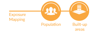
Starting from 2021, the Exposure Mapping is a new component in the Copernicus Emergency Management Service. The objective is the periodic production of global geospatial information on human settlements in the form of built-up area grids.
Detailed information on exposure is fundamental to adequately manage crisis and assess disaster risk. It allows answering questions like: How many people are living in a flooded area? or How many settlements will be affected by a cyclone?
The core objective of the CEMS exposure mapping component is to provide, with the Global Human Settlement Layer, highly accurate and continuosly updated information derived from satellite and census data on the presence of settlements and population. Outputs of this component are used in the on-demand mapping and early warning and monitoring components. In addition, the information is relevant for many other application domains (SDG monitoring, urbanisation, sustainable development).
An update to extend the time series is currently under production by the JRC, while the operational production of built-up area information under Copernicus EMS is under development. A prior information notice is currently issued to inform about the Global Human Settlement Layer in the Copernicus Emergency Management System.
Essential reading
Melchiorri M., Kemper T.
Citation:
M. Melchiorri; T. Kemper:
Establishing an operational and continuous monitoring of global built-up surfaces with the Copernicus Global Human Settlement Layer.
2023 Joint Urban Remote Sensing Event (JURSE), Heraklion, Greece, 2023, pp. 1-4
PID: doi:10.1109/JURSE57346.2023.10144201
CEMS week 2021
The Exposure Mapping Component was showcased in two sessions during the CEMS Week 2021. The objective was to showcase GHSL concepts, methods, and applications, and second to illustrate the characteristics of the 2022 GHSL data release, and especially the built-up area layer. In the session, it was first displayed the pre-release version of the GHS-BUILT based on Sentinel-2 data which maps built-up area fraction at 10 m resolution for the epoch 2018, introducing the characterisation of built-up area in residential and non-residential built-up area, and in high, medium and low vegetation surfaces. A preview of the GHSL evolution is visible via a new web visualisation.
To know more about GHSL data evolution check the following presentations